Live Satellite View Earth Maps: The Ultimate GPS Navigation Experience
Live Satellite View Earth Maps is a free travel and navigation app developed by HS Tech Apps for Android. This app is perfect for hikers, drivers, and those who love to explore the world. It uses GPS to display all locations in real-time 3D earth map. With the Route finder feature, you can easily find the shortest way to your destination. The app also provides street view 360 and GPS navigation to help you plan your trips.
Top Recommended Alternative
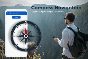
Live Satellite View Earth Maps not only shows your current location but also the famous places closest to your location on the Street View and Satellite Map. You can find the distance between two places and the arrival time with the Distance Finder feature. The app also includes a compass tool, ISD code, and address finder features. With Live Cam & Satellite View, you can search the place you want to go and turn on the 360-perspective feature.
Overall, Live Satellite View Earth Maps is a comprehensive app that offers a unique GPS earth view experience. It provides real-time traffic updates, shortest routes, and nearest public places. The app is easy to use with its simple user interface and zoom-in/zoom-out functionality. It's perfect for travel enthusiasts who want to explore the world.